Surveyed in 1929, Issued in 1930
"Den-en-Chofu" 1:10,000 Scale
After rezoning, the current street grids emerged.
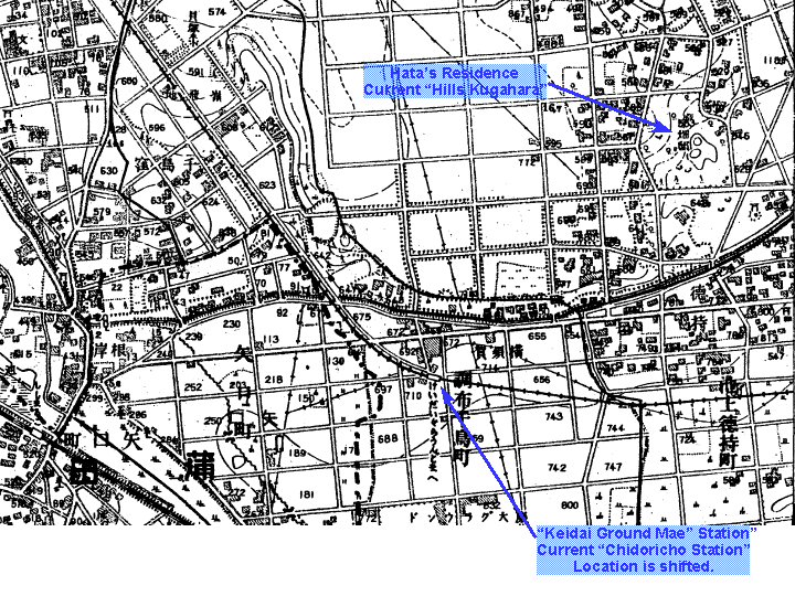
The land where "Hills Kugahara" now exists is marked as Hata's Resicence.
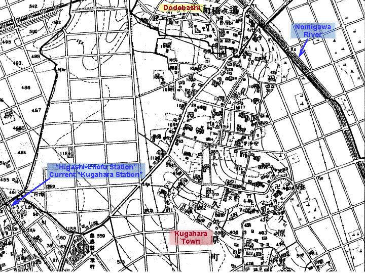
The Ikegami Line had been opened and Higashi-Chofu Station (current Kugahara Station) and Keio Ground Mae Station (current Chidoricho Station) can be seen.
The railway at the Northeast (upper left) corner of the map is Hinkaku Line, current Shinkansen and Yokosuka Lines.
This map has been copied from 1:25,000 scale topographic maps, 1:20,000 scale official maps and 1:10,000 scale topographic maps issued by Geographical Survey Institute (GSI), Ministry of Land, Infrastructure and Transport, Japan under an approval of the Director General of GSI.
(Approval Number Hei14SouFuku #408)[Letter of Approval (PDF file)]